*
The ∼2.23 Ga Hekpoort Formation (Transvaal sub-basin) and the ∼2.43 Ga Ongeluk Formation (Griqualand West sub-basin) represent voluminous Paleoproterozoic igneous events on the Kaapvaal craton of South Africa that predate the emplacement of the ∼2.055 Ga Bushveld Complex, and probably covered most of the craton at the time of their extrusion.

*
The Transvaal Basin in South Africa hosts a 15 km thick pile of sedimentary successions deposited over a period of more than 600 Ma during the Neoarchean to Paleoproterozoic.
*
Die Kaapvaal-kraton wat in Suider-Afrika geleë, is een van die oudste en enigste oorblyfsels van ongerepte Argeaanse kors, waarvan die Makhonjwa-berge (Barberton) deel is.
Die grootste krater, die Vredefort-krater word ook hier aangetref. Volgens die artikel is die Vredefort-krater nie die tweede oudste krater wat bekend is nie, dit is eintlik die derde oudste waarvan kennis geneem is. Daar is een ouer as die Yarrabubba-krater, die Suavjärvi-krater, geleë in Rusland.
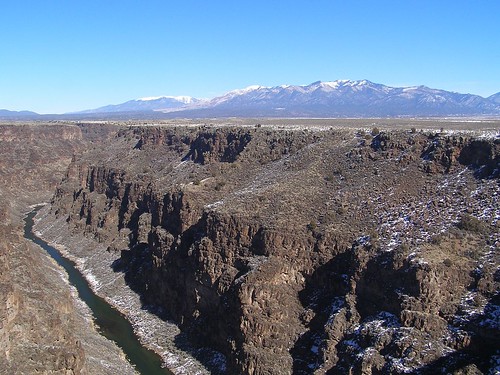
SOUTH AFRICA
The Kaapvaal Craton, located in Southern Africa, is one of the oldest and only remnants of pristine Archean crust. The Makhonjwa mountains are located here, and have some of the oldest evidence of life on them. The largest crater can also be found here: The Vredefort Crater. Apparently, the Vredefort Crater isn’t the second oldest crater known, it’s actually the third. There’s one older than the Yarrabubba crater, the Suavjärvi crater, located in Russia.
*
The Hekpoort Formation consists of a thick subaerial volcanic sequence in which volcanoclastic rocks occur mainly at the base. Rare, localized hyaloclastites and variolitic rocks record the presence of ponded water, while interbedded sedimentary rocks and paleo-weathered flow tops suggest prolonged time-breaks in volcanic activity. The Hekpoort rocks underwent metamorphism up to greenschist facies but also episodes of metasomatism and silicification. Preserved primary magmatic minerals are clinopyroxene (pigeonite, augite and diopside), and rarely plagioclase (labradorite).
https://www.sciencedirect.com/science/article/abs/pii/S0301926818301463
*
The craton covers approximately 363,000 square miles (585,000 km2) near the southern tip of the African continent. The craton is bordered on the north by the highgrade Limpopo mobile belt, initially formed when the Kaapvaal and Zimbabwe cratons collided at 2.6 billion years ago. On its southern and western margins the craton is bordered by the Namaqua-Natal Proterozoic orogens, and it is overlapped on the east by the Lebombo sequence of Jurassic rocks recording the breakup of Gondwana.
*
Botsings / aardbewings
Die kraton beslaan ongeveer 363 000 vierkante myl (585 000 km2) naby die suidpunt van Afrika. Die kraton word in die noorde deur die hoëgraad Limpopo mobiele gordel begrens, wat aanvanklik gevorm is toe die Kaapvaal en Zimbabwe kraton op 2,6 miljard jaar gelede gebots het.
Aan sy suidelike en westelike rande word die kraton begrens deur die Namakwa-Natalse Proterosoïese orogene, en dit word in die ooste oorvleuel deur die Lebombo-reeks Jurassic-gesteentes wat die opbreek van Gondwana aanteken.
read more about this:
Fjord in Namibia
*
Cratons in Africa
The Kalahari craton in the south comprises the Zimbabwe and Kaapvaal cratons, the Congo craton occupies much of central Africa, and the West African craton is located in northwest Africa. The East African Orogen includes the Arabian-Nubian shield in the north and the Mozambique Belt in the south, whereas the active East African Rift cuts from the Gulf of Aden past Lake Victoria to the Mozambique Channel, and offshore to Madagascar.
*
Die Kalahari-kraton in die suide bestaan uit die Zimbabwe- en Kaapvaal-kraton, die Kongo-kraton beslaan baie van Sentraal-Afrika, en die Wes Afrika-kraton is in Noordwes-Afrika geleë. Die Oos-Afrikaanse Orogen sluit die Arabies-Nubiese skild in die noorde en die Mosambiek-gordel in die suide in, terwyl die aktiewe Oos-Afrikaanse Skeur van die Golf van Aden verby Victoriameer na die Mosambiekse Kanaal en van die kus na Madagaskar sny.
*
Melville Koppies, Johannesburg
Greenstone belts are considered to represent ancient volcano — sedimentary basins bordered and intruded by granitic plutons. These formations represent an important phase of crustal evolution and currently it is commonly considered that they are remnants of back-arc basins.

Snaakse vorms van Groensteengordels wat as antieke vulkaan beskou word — sedimentêre komme wat deur granitiese plutone begrens en binnegedring word. Hierdie formasies verteenwoordig ‘n belangrike fase van kors-evolusie en tans word dit algemeen beskou dat hulle oorblyfsels van agterboogbekkens is. Dit bevat meestal water (ondergronds).
*
There are six main greenstone belts in the Kaapvaal craton, the most famous of which is the Barberton greenstone belt.
Although many studies have attempted to group all of the greenstone sequences of the Kaapvaal craton into the term Swaziland Supergroup, there is little solid geochrono-logic or other evidence that any of these complexly deformed belts are contemporaneous or related to each other, so this usage is not recommended.
Other greenstone belts include the Murchison, Sutherland, Amalia, Muldersdrif, and Pietersburg belts. U-Pb (Uranium-Lead) isotopic ages from these belts span the interval from 3.5 to 3.0 billion years ago, a period of 500 million years. The greenstone belts include structurally repeated and complexly folded and metamorphosed sequences of tholeiitic basalts, komatiites, picrites, cherts (or metamorphosed felsic mylonite), felsic lava, clastic sediments, pelites, and carbonates. Possible partial ophiolite sequences have been recognized in some of these greenstone belts, particularly in the Jamestown section of the Barberton belt.
https://www.climate-policy-watcher.org/plate-tectonics/kaapvaal-craton-south-africa.html
https://www.climate-policy-watcher.org/plate-tectonics/witwatersrand-basin.html
*
Map showing (a) the locations of the Kaapvaal Craton and the Transvaal Basin in South Africa, and (b) the locations of the three main volcanic units (Bushy Bend Lava Member, Hekpoort Formation, Machadodorp Member) within the Transvaal Basin.

*
IGNEOUS ROCKS
Where Igneous Rocks Are Found. The deep seafloor (the oceanic crust) is made almost entirely of basaltic rocks, with peridotite underneath in the mantle. Basalts are also erupted above the Earth’s great subduction zones, either in volcanic island arcs or along the edges of continents. Igneous rocks can be divided into four categories based on their chemical composition: felsic, intermediate, mafic, and ultramafic.
Waar stollingsgesteentes gevind word. Die diep seebodem (die oseaniese kors) bestaan feitlik geheel en al uit basaltgesteentes, met peridotiet onder in die mantel. Basalt kom ook bo die Aarde se groot subduksiesones uit, hetsy in vulkaniese eilandboë of langs die rande van vastelande. Stollingsgesteentes kan op grond van hul chemiese samestelling in vier kategorieë verdeel word: felsies, intermediêr, mafies en ultramafies.
Igneous rocks are formed from the solidification of molten rock material. Some form below Earth’s surface.
https://geology.com/rocks/igneous-rocks.shtml#:~:text=Igneous%20rocks%20are%20formed%20from%20the%20solidification%20of%20molten%20rock%20material.&text=Extrusive%20igneous%20rocks%20erupt%20onto,rhyolite%2C%20scoria%2C%20and%20tuff.
https://www.nationalgeographic.org/encyclopedia/igneous-rocks/
https://www.nationalgeographic.org/topics/rocks/?q=&page=1&per_page=25
