Have you ever wondered how mapmakers made bird’s-eye-view maps before the invention of satellites or even hot air balloons? How did Leonardo da Vinci did this more than 500 years ago?
*
It has been 500 years since the death of the Italian painter Leonardo Da Vinci. The sculptor, architect, and engineer was born near the town of Vinci in 1452 but spent most of his professional life in Florence and Milan.
*
Leonardo da Vinci: Celebrating his genius, 500 years on MAY 2019
*
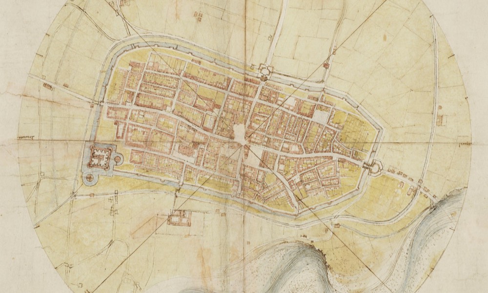
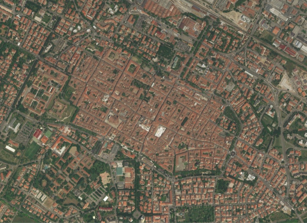
Here is Leonardo’s Imola map (cropped) compared with a contemporary satellite image: